RAWE Report 2017
•
59 gostaram•44,278 visualizações

The document provides details about a Rural Agricultural Work Experience (RAWE) program conducted by the Institute of Agricultural Sciences. The 3-sentence summary is: The RAWE program aims to provide practical agricultural experience to students through involvement in farm activities with local farmers, conducting surveys and farm planning, and extension education work in villages. Students are divided into groups and assigned villages to work in for a period of time. The program orientation provides training in participatory rural appraisal techniques to acquaint students with the socio-economic conditions of the villages.

Recomendados
Mais conteúdo relacionado
Mais procurados
Mais procurados (20)
Semelhante a RAWE Report 2017
Semelhante a RAWE Report 2017 (20)
Último
Último (20)
RAWE Report 2017
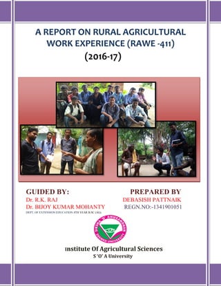
- 1. A REPORT ON RURAL AGRICULTURAL WORK EXPERIENCE (RAWE -411) (2016-17) GUIDED BY: PREPARED BY Dr. R.K. RAJ DEBASISH PATTNAIK Dr. BIJOY KUMAR MOHANTY REGN.NO:-1341901051 DEPT. OF EXTENSION EDUCATION 4TH YEAR B.SC (AG) Institute Of Agricultural Sciences S ‘O’ A University
- 2. Rural Agricultural Work Experience (2016-17) 1 | P a g e Institute of Agricultural Sciences (S’O’A University) Introduction Agriculture in India is a major economic sector and it is the backbone of Indian economy. It creates plenty of employment opportunities as well. About 65% of Indian population depend directly on agriculture and it account around 15% of crop. The RAWE (Rural Agricultural Work Experience) is conducted in the 7th semester of forth year .The main aim of the programme is to acquaint the students with the villagers and the farming situation so that they can have practical knowledge about agriculture.
- 3. Rural Agricultural Work Experience (2016-17) 2 | P a g e Institute of Agricultural Sciences (S’O’A University) Rural Agricultural Work Experience Agricultural education is an important tool and technique in ensuring gradual increase in agricultural productivity and sustainability in productivity, environment and ecological security, profitability, technical feasibility, job security and equity in distribution. What is RAWE ? Agricultural education is a dynamic one, which is undergoing change in a very rapid manner to meet the need of the society. Under this situation, Rural Agricultural Work Experience Programme (RAWE) is an important competence and confidence building programme activity introduced in many SAUs. In India, Randhawa Committee (1992) recommended the RAWE Programme for imparting quality, practical and productive oriented education for the agriculture degree programme. In fact experiential learning is exactly what the name implies learning from work experience. Effective work experience training strategies incorporating rural agricultural experiential learning approaches provide opportunities for a student of the last year to engage in field work activity, to review and analyze critically this work experience activity and to draw some useful conclusions, decisions, from this analysis and apply the result in actual practical life and field situation. It(Rural Agricultural Work Experience) is a programme for impairing quality, production and practical oriented education for agriculture degree.
- 4. Rural Agricultural Work Experience (2016-17) 3 | P a g e Institute of Agricultural Sciences (S’O’A University) Importance of RAWE Programme Preparing agricultural graduates for better career in agriculture. Preparing agricultural graduates oriented education to face the challenges by acquiring knowledge & skill though hands on experience. Objectives of RAWE Understanding the rural life by students. To get familiarize with the socio-economic conditions of the farmers & their problems with reference to agricultural development. To provide an opportunity to the students for practical training in crop production through work experience. To develop communication skills among students using extension teaching methods in transfer of technology. To develop the understanding regarding agricultural technologies being followed by farmers and to prepare alternate farm plans to suit to the local situation in consultation with farmers. To develop confidence and competence in students for solving problems related to agriculture. To make students understand the role of men and women in agriculture and allied sectors. To make the students acquainted with ongoing thrust on rural development related to transfer of technology. To explore and develop understanding regarding hi-tech agricultural technology & factors affecting the adoption of
- 5. Rural Agricultural Work Experience (2016-17) 4 | P a g e Institute of Agricultural Sciences (S’O’A University) modern method of agriculture the adoption of modern method of agriculture by the farmers. Involving in farm activities Involvement in day to day agricultural operation with host farmer, Calendar of operation for semester will be prepared in consultation with host farmer for a year, at least 2 crops, field and horticultural may be chosen, Comparison of farmers activities with the recommended practices, Choosing suitable recommended practice benefiting to farmer’s situation & resources, Maintaining daily diary by students with abstract of work done, Review of daily diary by chairman and programme coordinator Survey and farm planning Make PRA survey of the village, preparation of report and presentation. Collection of data on socio-economic condition, population, cropping pattern, irrigation facilities resources available, labour, employment. Preparation of action plan for the village in consultation with subject matter specialities and extension scientist of our Insitute for reorganisation of farm business for high income and suitable production. Identify the constraints in marketing of agricultural produce, institutional credit facilities, input supply agencies and cooperative enterprises.
- 6. Rural Agricultural Work Experience (2016-17) 5 | P a g e Institute of Agricultural Sciences (S’O’A University) Students shall record family budgets and information on farm holding of respondents farmers in prepared interview schedule. EXTENSION EDUCATION :- Identification agriculture related problem in the village. Conducting result and method demonstration. Organisation of farmer’s training and participation in programmes conducted by govt. agricultural and allied dept. Visit to local area study their role in development programmes and research works. Study the role of mass media. Participation I village social work, conduct survey for youth problems, initiation of youth and youth specific projects. Submission of report on extension activities. Sensitisation towards field agriculture. Hands on experience of village conditions with respect to agriculture. Development of favourable and required skill and attitude among agricultural graduates. Development of human resource in agricultural education. Thus, RAWE is a learner-centered approach of exposing undergraduate students of Agriculture college by using principles of “learning by doing” and “seeing is believing” to provide direction to think and act on their own.
- 7. Rural Agricultural Work Experience (2016-17) 6 | P a g e Institute of Agricultural Sciences (S’O’A University) About the District Khordha The District Khordha came in to existence on 1st April 1993, by dividing earlier undivided Puri district. Puri was divided into three districts Puri, Khordha and Nayagarh. The geographic location of Khordha district stands at 19degree 55minutes to 20 degree 25minutes North Latitude and 84 degree 55minutes to 86 degree to 5minutes East Longitude. Its climate is much influenced for the short radial distance from the Bay of Bengal and presences of a huge water body like the Chilika Lake. The district enjoys normal rainfall of 1408mm with maximum and temperature 42.2 degree Celsius and 11.1 degree Celsius respectively. Similarly, the mean relative Humidity ranges from 46% to 89% .It is situated in the East & Southeastern coastal plain and the agro-climatic zone is characterized by sandy- loam, Loamy, clay-loamy and clayey soil in varied agro-eco system. Khordha is divided into two sub-regions one is Deltaic Alluvium subregion which comprises of 3 blocks Balianta, Balipatna and Chilika Whereas Banpur, Begunia. Bhubaneswar, Bolagarh, Jatani, Khordha & Tangi belong to Lateritic sub-region. Khordha Latitude - 19°40’ to 20°25’ N Longitude - 84°40’ to 86°5’ E List of Blocks of the District and their Geographical extent. SL No Name of Block GPS Coordinates (North) GPS Coordinates (East) Total Geographical Area 1. Begunia 20° 12' 8.0784'' N 85° 27' 6.2640'' E 30610 2. Bhubaneswar 20° 17' 45.8124'' N 85° 49' 28.3440'' E 45729 3. Bolagarh 20° 10' 31.6272'' N 85° 16' 48.0252'' E 25260 4. Chilika 19° 31' 11.3340'' N 85° 6' 20.8404'' E 20172 5. Jatni 20° 10' 13.3608'' N 85° 42' 21.1284'' E 23447 6. Tangi 19° 55' 28.5816'' N 85° 23' 47.9220'' E 34374 7. Balianta 20° 46' 31.8216'' N 84° 20' 48.6528'' E 14971 8. Balipatna 20° 11' 58.2324'' N 85° 57' 34.4880'' E 14227 9. Banapur 19° 46' 17.0796'' N 85° 9' 48.5676'' E 40650 10. Khurda 20° 11' 36.4380'' N 85° 37' 59.5524'' E 31860
- 8. Rural Agricultural Work Experience (2016-17) 7 | P a g e Institute of Agricultural Sciences (S’O’A University) Agricultural Scenario of District KHORHDA Information on farmers of the district Farmers Nos % of holding Area % of Area Marginal 82719 67.45 37954 33.74 Small 27943 22.79 37952 33.43 Semi medium 9986 8.14 26216 23.10 Medium 1878 1.53 9906 8.73 Big 95 0.09 1472 1.00 Total 1,22,621 100.00 113500 100.00 Land Use Pattern Geographical Area (ha) 281300 Forest area (ha) 61867 Permanent Pasture (ha) 5498 Misc. Trees and Grooves (ha) 10369 Land put to Non-Agril. use (ha) 60066 Current Fallow (Ha) 3340 Net Area sown (ha) 132108 Cultivated Area(ha) 124650 Cropping Intensity 155.1% Rainfall Normal Annual Rainfall(Mm) 1568.1 Number of Rainy Days 54 Days Average annual rainfall Maximum - Bhubaneswar and Balianta Lowest - Blaipatna Block Agro-Ecology, Climate, Hydrology and Topography Agro-climatic Zone East & South Eastern Coastal Plain Zone Maximum Temperature 41.50 C Minimum Temperature 150 C Potential evapotranspiration Summer-23.4 Winter-36.13 Rainy-26.78 Soil Profile Mixed Grey Soil (Inceptisols) 183329.61ha Matured, Red&Lateritic Soil (Alfisols) 42257.7ha. Black soil 2823.12ha.
- 9. Rural Agricultural Work Experience (2016-17) 8 | P a g e Institute of Agricultural Sciences (S’O’A University)
- 10. Rural Agricultural Work Experience (2016-17) 9 | P a g e Institute of Agricultural Sciences (S’O’A University) ORIENTATION PROGRAMME ON RAWE RAWE programme was arranged in a synchronized manner under the guidance of highly experienced teachers. We were firstly made acquainted with the village & its condition in classroom teaching before use were exposed to village directly. There was an orientation programme of about 5 days i.e. from 4th July 2016 to 9th July 2016. The main aim of orientation was to aware the students about that work which is to be done in the village during village attachment programme .The orientation programme started from morning on 4th July 2016 with the presence of our dear sir all faculty members of extension education & many programme supervisors were present in that programme .The programme was conducted by the RAWE chairperson Dr. Rajkishor Ray & Dr. Bijoy Mohanty sir. We were given training about different techniques in PRA.In this 1week we came to know about PRA tecniques & how to implicate at village level. During this programme all the students were grouped in to 10 groups constituting 10-11 members each & allotted with 6 no. of villages out of which 3 are coming under irrigated command area viz. Brahmansarangi, Raedpada, Jagannathpur and non irrigated area such as Kateni,Giringaput,and Mendhasal. Our group consisting of 11 members. 1. Debasish Pattnaik 2. Bimal Prabhat Das 3. Bikash Nayak 4. A.R. Daniel 5. Subham Rath 6. Sidhant Sekhar Behera 7. Sabyasachi Parida 8. Saroj 9. Khetriya Umakant Biswal 10.Rasmikanta Sahoo 11.Subrat Mahali And the village allotted to us are Rayedpada (Irrigated) Mendhasala(Rainfed)
- 11. Rural Agricultural Work Experience (2016-17) 10 | P a g e Institute of Agricultural Sciences (S’O’A University) AGRO ECOSYSTEM ANALYSIS Agro ecosystem analysis helps to understand the prevalent socio-economic conditions of an area. Participatory methods and tools are mainly used for this purpose. PRA grew out of a general feeling of the users of the PRA that the farmers on the rural people are being entreated for information. Farmers do not truly know to participate. Evaluating field data at the same time could benefit people to learn about their problem. Analyse it and to make awareness. Here certain elements were required to make PRA more participatory. “Robert Chambers” is the father of PRA. PRA is a methodology for interacting with villagers and seeking their participating in putting forward their point of views about problem analysing and equalizing the information to acquire learning. It takes into account the people indigenous knowledge. It can be defined as, “A growing family of approaches and methods that enable local people to share enhance and analyse their knowledge of life and condition to plan and act.” Rapid Rural Appraisal This is done in very short period. Latter RRA is rethought as PRA. Due to its advantage it is expand to corporate sector, administrative, educational institution system. Participatory learning action and management. Here feedback is included.
- 12. Rural Agricultural Work Experience (2016-17) 11 | P a g e Institute of Agricultural Sciences (S’O’A University) Philosophy of PRA Knowing the people’s life in agro eco system; Greater ability to represent accurately; potential of analyse, plan, implement, monitor and evaluate with perfection, PRINCIPLES optimal ignorance, seeking diversity, offsetting biasness, learning from people, triangulation, Objectives of PRA For better and greater involvement of villagers by learning, perception, experiences and capabilities. To generate information and collection of data for immediate and future use. For validation and cross-checking of of collected data from otjer sources. For learning about the impacts of earlier on outgrowing policies and programmes and to frame new ones. For studies on research on the use of PRA and to suggest improvement by its methodology. Sources of PRA: active participatory research agro-economic analysis, applied anthropology, field research on farming system, rapid rural appraisal, Utilities of PRA:
- 13. Rural Agricultural Work Experience (2016-17) 12 | P a g e Institute of Agricultural Sciences (S’O’A University) 1) Natural resource management a) wild life resource buffer zone, b) village plans, c) rural energy assessment, fuel, fodder, d) forestry, 2) Agriculture a) Cropping and animal husbandry including farmer’s participatory research, b) Farming system research by farmers, c) Irrigation including rehabilitation of small scale growing flow, d) Irrigation system, e) Markets, 3) Programming for equality a) Women b) Credit c) Health d) Selection e) Income earning 4) Health and nutrition a) Food security and nutritional assessment, planning and location, b) Health assessment and monitoring, Purpose of PRA To use criteria, choices and understand the local environment clear and priorities, To learn farmer’s indigenous technology, To achieve triangulation using different methods and involving various people for check and feedback, To develop self-critical analysis and direct contact with local need and communities,
- 14. Rural Agricultural Work Experience (2016-17) 13 | P a g e Institute of Agricultural Sciences (S’O’A University) Guidelines for conducting interaction in PRA Before 1) Meet the villagers with an open and frank mind, 2) Build personal rapport building, 3) Identifying villagers who are interested to share their experience, 4) Always begin the interview by relaxing the tension of interview by asking general question, 5) Climate setting, 6) Select a suitable place foe interview, 7) Sit down with the villagers with same floor, After 1) Listen carefully, show empathy and be patient, and 2) Intense and careful observation is most important, 3) Do not interrupt, suggest or prescribe, 4) Be polite and accommodative and gentle, 5) Try to adjust with the human being as they are human beings, 6) Head nodding during interview is approval, 7) Participate whole heartily, 8) Accept villagers’’ offerings of hospitality, 9) There is no point of getting impatient or becoming too much when the villagers discuss among themselves, 10) Use what, which, when, where, why and how to rephrase the question, 11) At the end of the interview all the interviewer must be thanked individually by the members of the interviewing group for giving time and sharing their experience. 12) Sit down with all the members and record all the information collected and the process of information generation,
- 15. Rural Agricultural Work Experience (2016-17) 14 | P a g e Institute of Agricultural Sciences (S’O’A University) Components of PRA 1) Group formation A PRA team must consists of 4 members namely:- a) Lead facilitation- lead the group, b) Process recorder- record how the process went on actively happened, what difficult and interesting things are done, c) Content recorder- take a note of whole technology that have been discussed, d) Environmental controller- he monitors to create a suitable process to carry out the process, Multidisciplinary team with a social scientist and 7-8 numbers of members in a group is a good one 2) Kits collection Drawing sheets, sketch, colour pens, chalk, colour powder, pencil, scale, leaves and pebbles can be collected from villagers, 3) Arrival at village, 4) Rapport building, 5) Appraisal 6) Transact of village Contain all information about land situation, different opportunity of village on a single sheet paper 4 types of activities are to be undertaken: a) Space analysis b) Time analysis c) Flow analysis d) Decision analysis
- 16. Rural Agricultural Work Experience (2016-17) 15 | P a g e Institute of Agricultural Sciences (S’O’A University) Space analysis : This consists of all modelling and mapping village map, social map, topography map, hydrology map, crop map, enterprise map, many other maps by villagers. Time analysis: In this process, information are collected on seasonality of activity that is to be undertaken during PRA exercise in village. This includes crop calendar; fodder availability; labour shortage, food availability, food storage, shortage, incidence of disease and pest of crop and animal, charges and trends in village, time line of a village and many more relating to seasonal variations. Flow analysis: In this process, the information will be collected on message flow, the important exercise is to be done in diagram. Decision analysis: Consists of information collect and development of the preference and choice of the farmer This is the construction of a village area using rangoli powders or coloured chalk on the ground or a cement floor for understanding the village lay out ,main features such as housing, temples, stores and other infrastructure and other resources like forests, lands, watersheds etc. Purpose To get an impression of the social and physical layout of the village as perceived by villagers themselves.
- 17. Rural Agricultural Work Experience (2016-17) 16 | P a g e Institute of Agricultural Sciences (S’O’A University) To understand globally the social structure of the village, which live there, which facilities is there, where they are located etc. To get an impression of the natural resource environment of the village as perceived by the villagers. Situation Where Applicable Participatory maps are useful in identifying status of land holding and animals of different households. In identifying beneficiaries of various developmental programmes etc. Through participatory mapping other items like dry land/ irrigated land, rivers, forest lands and temple lands, tanks and nullahs and other water resources could be identified. The participatory mapping can also be used to prepare treatment plans for soil and water conservations, forestry and other treatments.
- 18. Rural Agricultural Work Experience (2016-17) 17 | P a g e Institute of Agricultural Sciences (S’O’A University) Following are the PRA tools Rapport building Rapport building is the first step in PRA. It is the first informal interaction with the farmer and village people It is meant for making relationship with others quickly and to gain trust and confidence. It imposes a good impression upon village people. So that the interaction between the facilitators and the participants in the PRA process becomes easier. For rapport buildings following things are to be remembered:- 1. Informal chat 2. Empathy 3. Leading question technique 4. Triggering mechanism 5. Chain reaction 6. Group dynamics 7. Local and personal language 8. Focus group discussion 9. Listening 10.Buried question technique TRANSECT WALK INTRODUCTION A transect walk is a useful method for knowing rural ecological conditions. A transect walk is a systematic walk along a defined path (transect) across the village area which is undertaken by the team along with the local people to explore the agro-ecosystem of the village and by observing, asking, listening, looking and producing a transect diagram. A Transect depicts a cross-sectional view of the different agro-ecological zones and provides a comparative assessment of the Zones on different parameters.
- 19. Rural Agricultural Work Experience (2016-17) 18 | P a g e Institute of Agricultural Sciences (S’O’A University) OBJECTIVES 1. Appraisal of natural resources in terms of status, problems & potential. 2. To get an idea about farming practices, cropping pattern, the physical layout (existing or planned), irrigated facilities etc. 3. To know the agro ecosystem of the village. 4. To get the cross sectional view of the village. Type of issue that might be covered in transect:- Food storage Community resource Difference in households and their assets Credit sources Agriculture production and constraints Livestock management Health assets and hazards Water resource and hazards Village infrastructure Land use pattern and seasonal variation Livelihood strategies Crops and other food production Gathered foods and medicine PROCEDURE Before Before commencement of the transect walk, we have explained briefly the purpose of the walk & selected the area under study
- 20. Rural Agricultural Work Experience (2016-17) 19 | P a g e Institute of Agricultural Sciences (S’O’A University) village resources like irrigation sources, water catchment area, vegetation, land resources etc. During We have observed everything in detail and listened carefully. We have also asked & recorded everything what we saw and listened, sketched and drawn the maps. We have walked up to the last boundary & covered all the relevant sides. After Carefully documented all the information collected by all team members. We have prepared final diagrams and sketch from the rough sketches. We have cross checked and compared the information by meeting other villagers & recorded how things differ from one situation to another. Village Map It is a map where all the entities of a village like temples, roads, water bodies, fields, houses etc. are represented by conventional sigs. Process of making: This is the construction of a village map by using rangoli or coloured chalk on the ground or on cemented floor for understanding the village lay out and the features such as houses, temples, stores and other infrastructures and the natural resources like forest land, waste land etc. Purpose of drawing village map:
- 21. Rural Agricultural Work Experience (2016-17) 20 | P a g e Institute of Agricultural Sciences (S’O’A University) 1. To get an impression of the social, physical layout of the village by villagers themselves, 2. To understand globally the social structure of the villages who live there, what facilities are available, 3. To get an impression of the natural resources environment of the village perceived by the villagers. Hydrology Map It is another kind of map that shows the depth of water in various water bodies present in that locality. The hydrology map of a village delineates the status of water resources, distribution pattern, drainage facilities, direction, nature, inundation, water regime and water use pattern. Purpose To know the position of the water resource, distribution pattern and the water table depth, so that these data will help in the decision making process and action plan development. Process Along with our respected farmers, we sat on the village verandah with all the chalk, coloured powder, and prepared the hydrology map having all the necessary signs for tube wells and other water structures. Social Map A social map depicts the location of different things like presence of road, rivers, institution, characterisation and condition of household, the ownership of dwelling and building land pattern, poor, non-poor household and dwelling of difficult caste in village. Purpose
- 22. Rural Agricultural Work Experience (2016-17) 21 | P a g e Institute of Agricultural Sciences (S’O’A University) To get an impression about physical layout of the village, To understand social structure of the village, Process We collected material like rangoli powder, chalks, gravels, colour and stick etc. are used for mapping. We arranged papers for redrawing the map which was drawn on the ground. Then we organised the villagers and the veranda. Crop Map It is a kind of map where different types of crop grown in a locality are represented in a map. Different types of crops and villages like potato, cauliflower, cabbage, rice, pulses,brinjal,tomato, okra etc. are grown and are represented by respective signs. Purpose To know the potential crop area, main crop, verities, cropping system, pattern etc. To get all information about crop for the preparation of action plan, Process We all gathered the villagers along with the requisites for map like colour chalks, rangoli, stand, stone, gravel etc. and sat on the village veranda to draw the map. We redrew the map on our daily record RESOURCE MAP DEFINITION: It is the type of map locates resources of an area such as village watershed, forest water bodies etc, this helps to established the extent and location of these resource and
- 23. Rural Agricultural Work Experience (2016-17) 22 | P a g e Institute of Agricultural Sciences (S’O’A University) analysis and understand them better. OBJECTIVE: Resource maps have been used for depicting of various aspects related to Different type of resources just like crop, water resources, natural resources, human resources, implement ,enterprises resources availability in village. What type of land, what type of road all type of resources discussed on it. PROCEDURE:- We have selected a proper place for preparing a resource map and explain the purpose of the exercise. We have encouraged them to use locally available material in a creative way & to make the map as representative as possible. We have asked the participants to draw the boundaries of the village. We have asked the participants to draw a map of the village showing all resources. For orientation it will be helpful to draw roads and significant spots of the village into the map. We have asked the participants to also show institutions, buildings and places that offer some kind of social service or which are popular spots to meet and discuss. Example: variety type of resource shown to me by the help of viilagers.in this village main resources human ,hydrology resources are important. At the end, we have asked them whether anybody would like to make any modifications or additions.
- 24. Rural Agricultural Work Experience (2016-17) 23 | P a g e Institute of Agricultural Sciences (S’O’A University) We have copied the map onto a large sheet of paper with all details USES: This map is useful in identifying the land holding, animals on the households, beneficiary of various developmental programmes, mapping of resource map was practise in the village by inviting people. They were asked about various resources available n the village. 1) Natural resources 2) Crop resources 3) Livestock 4) Hydrological 5) Human resources 6) Implements Venn Diagram It is also called as “Chapati diagramming”. It is a visual graphics made by villagers to present the role of the organisations, institution and degree of influence in their discussion making process. This was done by drawing circle by taking the village in the centre as a big circles depending upon its importance and accessibility of these institutions. Purpose To get the villagers’ prospective on the impact on the influence of local and outside institution in a particular. Process We selected an appropriate place and sat for discussion along with the farmers. Chappatis of different sizes were cut. The villagers are then asked to list all the institutions that were having impact in
- 25. Rural Agricultural Work Experience (2016-17) 24 | P a g e Institute of Agricultural Sciences (S’O’A University) their life. Then according to the size of importance, the names were written on the chappatis. Then they arranged those chappatis in order to their availability of those facilities. Then we note down that diagram on the daily diary. Mobility Map It is a tool of PRA which shows the distance between the various institution/ places present either inside or outside of the village. It helps us to find out the essentiality and the frequency of the visit to that place/institution by the villagers. Purpose The diagram is used to understand the places travelled, resource collected and to identify the person travelling. The resource centre could have some problem regarding road and transport, which may not be approximate. Process We along with our fellow farmers sat on a place in the village and discussed about the places that they visited and their essentiality. Then according to the prior idea about task they drew the mobility map and we also noted down it in our daily record. Application Some of the resources are in short supply in the community. The community action plan includes ways and means to get critical resources in the feature. The difficulties faced on the road and at the resources centre taken due consideration for improvement.
- 26. Rural Agricultural Work Experience (2016-17) 25 | P a g e Institute of Agricultural Sciences (S’O’A University) Daily Profile It depict show villagers (men and women) spend a day of 24 hours along with the kinds of activities and time allotted for each activities. Daily routine for taken for men and women in both categories farmers and farm labourers. Purpose To get an account for their daily life for men and women in both categories of farmers and farm labourers. 1. Time spent for both men and women, farmers and farm labourers in various activities in a day of 24 hours. 2. Data on wage earning, rest and recreation hours. 3. Data on leisure time which must be utilised by development workers. Process We arranged at the village at our usual time, after that we 1st of all we went to meet the villagers and then they were gathered, so that we freely discussed with them about their day to day life activities and their daily routine. In the beginning they were just skipping the small activities but gradually they informed all minor activities after we told them to inform the exact routine. We also told them what activities they had done in summer, kharif and rabi season. Their daily routine was different from person from person according to their occupation. Objective We had prepared this map in both the villages, so that we can assign some profitable production unit for the development of their standard of living by utilising their leisure period.
- 27. Rural Agricultural Work Experience (2016-17) 26 | P a g e Institute of Agricultural Sciences (S’O’A University) Seasonality Seasonality is a useful and important exercise to determine the seasonal pattern in rural village areas related to rainfall, farming practices, employment etc. In seasonality attempt is made to determine the seasonal calendar as understood and practised by the villagers. A seasonal calendar helps to present large quantities of diverse interaction in a common line of frame. It accompanies community activities month a cross sectional boundaries. Purpose To have an overview of seasonal variation by examining an off parameters related to farmer’s life. E.g. Work, employment, rainfall, income, availability of food and fodder. Suggestion for seasonality Before Set the climate for participatory discussion, Sit down with the informant, Initiate the discussion on particular topic During Ask the informant to explain the seasonality change and variation, They may write the name of the months on a small sheet of paper and put them in order, Then they put score as per the workload, disease, fodder availability, rainfall in that village. After Triangulation the findings in larger group during village presentation, Application
- 28. Rural Agricultural Work Experience (2016-17) 27 | P a g e Institute of Agricultural Sciences (S’O’A University) The seasonality exercise has a wide range of application i.e. to indicate rainfall, agricultural operation, employment generation, credit availability, fodder, milk yield. Trend Analysis It is a tool of PRA. It indicates the changes that have been taken place over a period of time. Importance: A trend line gives visual from to the villagers’ perception of significant change over a period of time. It is visualised in 2 terms. I. Quantity i.e. kg/ha, Q/ha, price etc. II. Quality i.e. positive, negative Problem Cause It is a process by which we can go to actual cause a particular problems prevailing in a particular village. By this we can make some intervention points so that action in that particular cause can be taken immediately. In both the villages we were assigned to find out the cause of 1st and 2nd main problems. Purpose: By analysing the cause the problem we can actually suggest/prescribe a useful action plan for that village which will be helpful.
- 29. Rural Agricultural Work Experience (2016-17) 28 | P a g e Institute of Agricultural Sciences (S’O’A University) Process: 1st of all, after reaching the village, we gathered some peoples and then explained the exercise to be conducted on that day. By using colour chalk we drew the map on the floor as told by the villagers and try to locate the actual cause of problem. After the exercise, we thanked the villagers for their participation and cooperation. Principle The principle aim is to identify the factors that resulted in the nature, the magnitude the location and the timing of the harmful outcomes of the one /more events in order to identify what behaviours, action, need to be changed to prevent damage of similar harmful outcomes and to identify the lessons to be learned. There may be more than one root cause for an event, the difficult part is demonstrating the persistence and sustaining to effort required to develop them. Timeline Timeline is a change a chronological sequences of event that has occurred in a particular which are given by the villagers as important. It refers to the calendar of historical event from as far back as one can remembered up to the life of a person, community, villagers/institution depending on what basis of helping us trace trends through history and to study of change. Purpose To find out the sequence of historical events, changes that has occurred in the village and their impact in the social and
- 30. Rural Agricultural Work Experience (2016-17) 29 | P a g e Institute of Agricultural Sciences (S’O’A University) agricultural base. Process Set the climate and encouragement the elderly presence of the village to join in the discussion .Carry a pen and sketch with a paper. Initiate discussion and ask questions to the older information first. Ask them to recapitulate the major events and changes that took place over the years. Do not insist two much or specific year or date. Record all the information, check and thank all the villagers. Compare the change and identify the bunds. Application The timeline exercise can be applied to find out the background of village/evolution of specific activities or programme. The time line of agriculture for example would indicate the occurrence of drought,the adoption of new crop and varieties ,HYV and hybrid introduction, fertiliser application etc. Problem Identification & Problem Priority A problem is any unsatisfactory situation. It is a hurdle/barrier for achieving goals/objectives. Objectives list out the problems present in the village, ritize the problems on the basis of the following things, those are Seriousness of that problem, Frequency of that problem, Distribution of that problem, tion and develop a satisfactory action plan, Process Democratically by participation of the villagers a number of problems of the village were identified and collected. The
- 31. Rural Agricultural Work Experience (2016-17) 30 | P a g e Institute of Agricultural Sciences (S’O’A University) villagers were asked to identify the problem must felt and widest concern affecting major people and should relate the family, community and national situation for tackling the selected problem. All problems were scored on the basis of its seriousness, frequency and distribution and then were ranked as 1st , 2nd , 3rd , etc. SWOT It is a pioneer step of PRA survey in order to achieve a big target within a short span of time. The analysis is generally conducted with respect to the existing farming system. It is analysed under 4 heading i.e. strength, weakness, opportunity and threats, For implementation of any programme like ecological, infrastructural, agro enterprise etc. the planning should be from top to bottom and execution should be bottom to top approach. Planning Implementation SWOT analysis is indispensable before execution of any plan. Threat area should be considered first. Matrix Ranking It is a PRA tool by which villagers’ preference and attitude towards a particular topic of interest is revealed to us. It helps us to understand farmer’s priorities towards crop varieties, vegetables, tree spices, livestock categories, soil and water conservation methods, irrigation methods etc. by this technique we can also know about the reason for their likes and dislikes towards the topic. In this, we select some criteria which are used to prioritise certain items or activities over other. These criteria
- 32. Rural Agricultural Work Experience (2016-17) 31 | P a g e Institute of Agricultural Sciences (S’O’A University) provides us an opportunity to think and look at things from a new angle and prospective. Purpose To get better understanding farmer’s decision making process. Process The people of different age group and classes included discussion of particular topic were initiated and all the varieties and species as told by the villagers were noted. They were asked to rank the varieties /species of their choices for each criteria by ranking 1- 10 against the best and worst one were written. At last following all criteria best verities was chosen. The overall ranking was examined carefully and which variety scores high in all most all criteria was observed. Resource Flow Resource flow analysis means whatever inputs for cultivation or food products either available within the village or import from the outside of village. When these all resources are designed into a map form it is called as resource flow map or inflow-outflow map. OUTCOME OF USING THESE TECHNIQUES First-hand information and maps Baseline information List of priorities Involvement of different groups of the village Identification of matrix Atlast Prepation of Action Plan by studing the above tools
- 33. Rural Agricultural Work Experience (2016-17) 32 | P a g e Institute of Agricultural Sciences (S’O’A University) A Brief overview of our total programme ACTIVITY DATE OF ACTIVITY Rayedpada Mendhasala Rapport building Village map Social map Crop map 12/7/16 & 17/7/16( rechecking) 25/7/16 26/7/16 Hydrology map 13/7/16 & 22/7/16(rechecking) 11/8/16 Resource map 11/8/16 Transact walk 11/8/16 Timeline 11/8/16 Venn diagram 14/7/16 29/7/16 Mobility diagram 29/7/16 Matrix ranking 29/7/16 Seasonality 15/7/16 30/7/16 Trend analysis 30/7/16 Daily work resource 16/7/16 29/7/16 ITK 29/7/16 Swot analysis 8/8/16
- 34. Rural Agricultural Work Experience (2016-17) 33 | P a g e Institute of Agricultural Sciences (S’O’A University) Village- Raedapada(Irrigated)
- 35. Rural Agricultural Work Experience (2016-17) 34 | P a g e Institute of Agricultural Sciences (S’O’A University) RAEDAPADA Raedapada is present in the Balianta block of Khurda district. This village is totally irrigated. The irrigation is mainly through Danapada canal. It is totally surrounded by water sources such as canal, and ponds. Bhubaneswar-Block Area(Ha)- 45729 Balianta-Block Area(Ha)- 14971 Block – Balianta Grampanchayat – Kakarudrapur District – Khurda Total Geographical area of Village: Rayedpada(in acre) Cultivated Agricultural Land 132.5 acre Other (Gochar Land+Government Land+Social Forestry) 10 acre Homestead Area 30 acre Total Area(Acre) 172.5acre Cultivated Agricultural Land 76% Other (Gochar Land+Governm ent Land+Social Forestry) 6% Homestead Area 18% Total Geographical area of Village: Rayedpada(in acre)
- 36. Rural Agricultural Work Experience (2016-17) 35 | P a g e Institute of Agricultural Sciences (S’O’A University) Rapport Building On 12th July 2016 we headed towards the village. We started communicating with farmers and some villagers about the basic information on the village. Then we came to know about the hamlets of village i.e. Barik sahi, Guru sahi, Ojha sahi, Mallick sahi, Bhoi sahi. We also have collected other basic informations on the village. Village Map After rapport building we created a group of farmers and villagers and started working with them and we collected the following informations and rectified the data from the Block Development Office. We started to make on floor diagrams with rangoli and made the total village map on floor to have a basic idea and move further Information about the village Topic Information Total area 172.5 acre Total population 547 Main road Panchola – Jagannathpur road Social structure 5 Hamlets Religious 5 temples, 2 masjids, 1 bhagabat tungi Crops Rice, Green gram, Black gram, Brinjal, Tomato, Okra, Amaranthus, Palak, Coriander, Mango, Guava, Papaya, Banana, Coconut Main water source Danapada canal, Pond, Tube well, Well, Supply water, Hand pump Institution U.P school, High school, Anganwadi, Youth club Enterprises 1 poultry unit,1 pisciculture unit, 1 mushroom farm
- 37. Rural Agricultural Work Experience (2016-17) 36 | P a g e Institute of Agricultural Sciences (S’O’A University)
- 38. Rural Agricultural Work Experience (2016-17) 37 | P a g e Institute of Agricultural Sciences (S’O’A University) Social Map We followed the same procedure but keeping in mind the basic way of communicating and asking several questions related to thei caste, religion etc. Villagers and farmers cooperated with us and we had done the social map. Man made resources Numbers Educational institution High school 01 U.P school 01 Anganwadi 01 Religious institution Bhagabat tungi 01 Temple 02 Social organization Club 01 Self Help Group 08 Social institution Hamlets(Sahi) Barik sahi, Guru sahi, Ojha sahi, Mallick sahi, Bhoi sahi Human resources Total house hold 135 Female 267 Total voter 410 ST 0 Big farmer 03 Marginal farmer 160 Business 20 Illiterate 129 Total population 547 Male 280 Children 67 SC 227 General - 320 Small farmer 90 Service holder 10 Literate 418
- 39. Rural Agricultural Work Experience (2016-17) 38 | P a g e Institute of Agricultural Sciences (S’O’A University)
- 40. Rural Agricultural Work Experience (2016-17) 39 | P a g e Institute of Agricultural Sciences (S’O’A University) Crop Map We have selected a proper place for preparing a crop map and explain the purpose of the exercise. We have encouraged them to draw the map as representative as possible on the drawing sheet. We have asked the participants to draw the boundaries of the village as well as the crop fields. We have asked the participants to also show different crops on their respective fields. At the end, we have asked them whether anybody would like to make any modifications or additions. The details of data about crops are as follows Enterprise unit Numbers Mushroom farm 01 Shop 05 Poultry unit 01 Pisciculture unit 01 Live stock resources Numbers Poultry – 10 10 Cows – 15 15 Crop resources Type Crop Pulses Green gram, Black gram Greens Amaranthus, Palak, Coriander Cereals Rice Vegetables Brinjal, Tomato, Okra Fruit crops Mango, Guava, Papaya, Banana, Coconut
- 41. Rural Agricultural Work Experience (2016-17) 40 | P a g e Institute of Agricultural Sciences (S’O’A University)
- 42. Rural Agricultural Work Experience (2016-17) 41 | P a g e Institute of Agricultural Sciences (S’O’A University) Hydrology Map For hydrology map we have discussed with the villagers about water resources, water table source of drinking water, source of irrigation channel(Danapada canal) Details of water sources Hydrological resources Numbers Tube well 06 Supply water 17 Canal 01 Ponds 04 Well 04 Hand pump 02 Pisciculture unit 01 Conclusion Though this village is irrigated but there is no good source of water for 2 crops. Due to less utilization of canal , the canal is degraded.
- 43. Rural Agricultural Work Experience (2016-17) 42 | P a g e Institute of Agricultural Sciences (S’O’A University)
- 44. Rural Agricultural Work Experience (2016-17) 43 | P a g e Institute of Agricultural Sciences (S’O’A University) Resource Map In resource map we focus on Land Resource, Water Resourse(Drinking water source & Irrigation channel). Details of resources are as follows Soil type Texture Medium land Sandy loam Up land – Sandy loam Low land Clay Agricultural impliments Numbers MB plough 01 Sprayer 02 Tractor 01 Winnower 01 Sickle 50 Desi plough 10 Iron plough 03 Bullock cart 02 Planker 06 Weeder 02 khurpi 60 Conclusion Though there are resources but it is not utilised properly. Farmers depends on rainfall as water source besides using canal and does only one crop of rice followed by moong & Kulthi.
- 45. Rural Agricultural Work Experience (2016-17) 44 | P a g e Institute of Agricultural Sciences (S’O’A University)
- 46. Rural Agricultural Work Experience (2016-17) 45 | P a g e Institute of Agricultural Sciences (S’O’A University) Transect Map While doing transect walk we started an elevation from the upland hill area and ended to the village residential area. We came across the following conclusions Soil type Texture Medium land Sandy loam Up land – Sandy loam Low land Clay Conclusion Most of the area is under low land & medium land. Water stagnation is a problem.
- 47. Rural Agricultural Work Experience (2016-17) 46 | P a g e Institute of Agricultural Sciences (S’O’A University)
- 48. Rural Agricultural Work Experience (2016-17) 47 | P a g e Institute of Agricultural Sciences (S’O’A University) Timeline Before At first the climate for a participatory discussion was set. Elderly people and knowledgeable villagers are encouraged to join the discussion as far as possible. Sheets of paper and sketch pen were carried with us. During Discussion initiated and questions were asked to the older informants at first. And they were asked to recapitulate the major events and changes that took place over the years. Some of them were asked to write down in chronological order. Information was recorded. After The changes were compared. The trends were identified. We thanked all the villagers for sharing their experiences.
- 49. Rural Agricultural Work Experience (2016-17) 48 | P a g e Institute of Agricultural Sciences (S’O’A University)
- 50. Rural Agricultural Work Experience (2016-17) 49 | P a g e Institute of Agricultural Sciences (S’O’A University) Trend Analysis We explained to them the purpose of the exercise. We tried to encourage the local people to depict interested aspects for trend analysis. We also facilitated the selection of time landmarks across which the trends could be studied. The participants are encouraged to depict the selected landmark years on cards preferably by symbols of visuals and so on. The participants were asked to make the matrix on the ground, using chalk. They represented from left to right the landmark years and from top to bottom various aspects like density of trees, grass, wild animals, etc. They were then asked to depict the situation today in the relevant cell using symbols, visuals, seeds, sticks, sand, etc., as the case may be, leave the choice to the participants. We moved to the next time landmark and so on.
- 51. Rural Agricultural Work Experience (2016-17) 50 | P a g e Institute of Agricultural Sciences (S’O’A University)
- 52. Rural Agricultural Work Experience (2016-17) 51 | P a g e Institute of Agricultural Sciences (S’O’A University) Venn Diagram The exercise is carried out by the help of villagers with use of different sizes of circle of paper which indicates the relative importance or accessibility of a particular institution or individual to that particular village. According to the villagers, various groups &institutions those mostly influence them and their activity are – a) Primary school b) Primary Health Centre c) Kissan mandi d) Block office e) Gram panchayat f) Police station g) Bank h) Temple i) Post office j) Local market k) K.V.K. l) Veterinary office m) Anganwadi n) R.I. Office o) Youth club p) Co-operative store q) College r) District health Centre
- 53. Rural Agricultural Work Experience (2016-17) 52 | P a g e Institute of Agricultural Sciences (S’O’A University) Before We selected an appropriate place and along with farmers we sat there for an open discussion. Papers of different sizes were cut. Then we set the climate for the discussion and told them about what to do. During The villagers were first of all asked to make a list of all the institutions that were having impact on life. We asked them to write the name of institution on the paper. The informants were asked to choose larger disc for more important institution and smaller ones for less important institutions. We told them to put at the centre, the largest circle to denote the village. The distance of the paper circle from the circle denoted the intensity of involvement. They were allowed to change papers after a second round of discussion. After We represented the whole information into the drawing sheets and denoted the different institutions with different colors according to their utilization.
- 54. Rural Agricultural Work Experience (2016-17) 53 | P a g e Institute of Agricultural Sciences (S’O’A University)
- 55. Rural Agricultural Work Experience (2016-17) 54 | P a g e Institute of Agricultural Sciences (S’O’A University) Mobility Map INFORMATION ELICITED FROM THE MOBILITY MAP 1. Places 2. Purpose 3. Direction 4. Distance 5. Mode 6. Frequency 7. Cost of transport to and from a village PROCEDURE We have selected the person, group or community whose mobility pattern you are interested in understanding. We explained the purpose of the exercise and initiate a discussion on the places they visit. We then listed down the places. As they close the list, they were asked whether they would like to add some more or delete any of the places in the list. They were asked to write the name of the places on small pieces of paper in bold letters. They were encouraged to depict the places using symbols or visuals, A circle was drawn in the middle of a paper or ground, representing the village/locality and ask them to locate the pieces of paper with the names of the places they visit around the circle in such a way that they are properly represented. We asked them to link the cards representing the places visited with the circle depicting their locality by lines. The thickness
- 56. Rural Agricultural Work Experience (2016-17) 55 | P a g e Institute of Agricultural Sciences (S’O’A University) of the lines could represent a particular feature, such as, the frequency of the visits. We asked them to follow a similar process, for all other places that they visit, one by one. They were encouraged to represent other aspects in the form of visuals, symbols or in writing. They were asked whether they would like to make any alterations once the diagram is ready. We requested them to explain the map and their learning from it. They were asked to explain the diagram in detail. Interview the diagram to clarify your doubts by asking probing questions. We listened carefully to their discussion and take any necessary notes. The diagram is copied onto paper with all the details.
- 57. Rural Agricultural Work Experience (2016-17) 56 | P a g e Institute of Agricultural Sciences (S’O’A University)
- 58. Rural Agricultural Work Experience (2016-17) 57 | P a g e Institute of Agricultural Sciences (S’O’A University) Resource Flow Analysis The resource flow diagram is a schematic drawing of the resource inflow into the village and resource out flow from the village. The diagram shows the flow of resources from the original source to the final output and visualizes the use and control of the resources Daily Work Profile We arrive at the village in our usual time, after that we first of all went to meet the villagers and then they were gathered so that we freely discussed with them about their day to day activities and their daily routines. In the beginning they were just skipping the small activities, but we told them that we needed the exact daily routine of both male and female, then they co-operated us in giving the data.
- 59. Rural Agricultural Work Experience (2016-17) 58 | P a g e Institute of Agricultural Sciences (S’O’A University)
- 60. Rural Agricultural Work Experience (2016-17) 59 | P a g e Institute of Agricultural Sciences (S’O’A University) Matrix Ranking Before After the initial round discussions and rapport building, a suitable place was selected to sit down and the exercise was conducted The people from different age groups and classes were included During Discussions on particular topic (e.g. varieties or tree species) were initiated and all the varieties and species as told by the villagers were noted. The farmers were allowed to state all the criteria & at point of controversies, few others opinion were taken. The villagers were asked to rank the varieties / spices of their choice for each criterion by ranking 1 to 10. 10 against the best and 1 for worst were written. Villagers used stones in each box against each criterion. After The overall ranking was examined carefully and which variety/ item scores high in almost in all criteria was observed. We thanked all participants for sharing their views. Conclusion The best variety for coconut water is Sakhigopal & for both water and coconut flesh it is Chaughat orange.
- 61. Rural Agricultural Work Experience (2016-17) 60 | P a g e Institute of Agricultural Sciences (S’O’A University)
- 62. Rural Agricultural Work Experience (2016-17) 61 | P a g e Institute of Agricultural Sciences (S’O’A University) Seasonality Before The climate was set for participatory discussions. We sat down with the informants(preferably from all the age groups ) We carried the paper sheets and colored pens. We initiated the discussions on particular topic (rainfall, labour demand, market rate of vegetables etc.) During We asked the informants to explain the seasonal changes and the variations and draw on a paper or on the ground. We helped them in developing skills to depict the seasonal variations and ask them to complete the graph. They wrote the name of twelve months on small sheets of papers and put them in order. Then bars using pieces of sticks or branches or columns using stones or seeds of different lengths developed to depict the rainfall, food stocks etc. After The findings were triangulated in larger groups during village presentation. We thanked all the villagers for participating in the exercise. Conclusion In the month of august there is maxim of rain fall.
- 63. Rural Agricultural Work Experience (2016-17) 62 | P a g e Institute of Agricultural Sciences (S’O’A University)
- 64. Rural Agricultural Work Experience (2016-17) 63 | P a g e Institute of Agricultural Sciences (S’O’A University) PROBLEM IDENTIFICATION AND PRIORITISATIONS Problem is a condition or situation that the people after study with or without help have decided need changing, problems are hurdles or barriers for achieving goals or objectives. The problems are generally prioritized on the basis of three parameters. Seriousness of problem ( refers to the degree to which damage has occurred due to the problem ) Frequency of occurrence ( refers to the number of occurrences of the problem during last 10 years period ) Distributions of problem (refers to the extent of occurrence of the problem which may be calculated on the basis of no. of people and amount of area affected). PROCESS Identification of problems was done by discussing with a group of farmers. All the problems in the area were collected and identified democratically through participation of village people. The villagers were asked to identify the problems, most felt and of widest concern affecting major people and should relate to the family, community and national situation. For tackling the selected problems, the time was scheduled on greatest priorities basis.
- 65. Rural Agricultural Work Experience (2016-17) 64 | P a g e Institute of Agricultural Sciences (S’O’A University) PROBLEM IDENTIFICATION AND PRIORITISATIONS PROBLEMS SERIOU SNESS OF PROBLE MS FREQUENC Y OF PROBLEMS DISTRIBUTION OF PROBLEMS TOTAL SCORE RANK Sheath blight in rice 9 8 7 24 1st Brinjal fruit and shoot borer 6 5 5 16 6th YMV in okra 5 7 6 18 4th Lack of irrigation facility 6 6 8 20 2nd Low income of farm women 4 5 7 16 6th High labour cost 5 6 8 19 3rd Crop loss due to cattle and monkey menance 5 5 7 17 5th Lack of storage facility 6 4 6 16 6th Conclusion Thus tme major problem in Rayadapada is Sheath blight of rice, & the least important problem is Lack of storage facility.
- 66. Rural Agricultural Work Experience (2016-17) 65 | P a g e Institute of Agricultural Sciences (S’O’A University) ROOT CAUSE ANALYSIS A problem has several causes such like biophysical cause & socioeconomic causes. We analyze the cause for the finding of interventions to solve the problems. There are primary secondary and tertiary causes of a problem. In both the villages we analyze the main problems of the villages.
- 67. Rural Agricultural Work Experience (2016-17) 66 | P a g e Institute of Agricultural Sciences (S’O’A University) INDIGENOUS TECHNICAL KNOWLEDGE (ITK) Use of begonia leaves for preventing insect pest attack in pulses. Treatment of jaundice people use a mixture of juice of fruit of satavari plant with added milk and khandasari in proportionate amount and give it to patient suffering from jaundice Water-soaked neempedia applied for plant protection In rice for control of gundhi bug use cow urine + kerosene + husk mixture for control of BLB in rice people use cow dung slurry. Use of cow dung to store pumpkin for more time. Mixing of sand with mung for long term storage. Seed mix with ash preent insects and grain pests. For the control of aphids use of detergent water in pulses. Use of salts in pits at the time of coconut planting to repels snails. Use of storage structures for paddy made out of wood and bamboo pieces called as BENTI and PUDUGA. These structures are kept 2 feet above the ground ion a base and grains are kept in it. Use of smoke to check the burning of flower of mango. Application of ash in mango tree to control ant and weevil Use of turmeric powder to prevent red ant in spinach.
- 68. Rural Agricultural Work Experience (2016-17) 67 | P a g e Institute of Agricultural Sciences (S’O’A University) SWOT ANANLYSIS Strength 1. Substantial paddy production. 2. Installation of solar panel to generate electricity. 3. Application of green manure. 4. Fishery has been practiced. 5. Mushroom cultivation from the straw harvested from rice field. 6. Availability of vocational training. 7. Water, Electricity, Fuel, BPL card facilities available. 8. Set up of cottage industry. 9. Communication facilities like roads are well built to sell the harvested goods in cities. Weakness 1. Flood in river. 2. Poor drainage. 3. Only one part of village is properly irrigated and other part doesn’t get water. 4. Ponds are filled with weeds like water hyacinth. 5. Monocropping is highly favored hence affecting soil fertility status. 6. Govt. incentives are not provided timely. 7. They are reluctant to adopt new scientific approach of farming. Opportunity 1. Availability of loamy soil which is highly fertile. They can go for growing fruit crops. 2. High paddy production hence they can go for processing of paddy and generation of new commodities. 3. Availability of plenty number of ponds so fishery can be heavily commercialized. 4. They have cows hence can establish Gobar Gas plant. 5. Fertile soil favors vegetable production. Threats 1. Monkey menance. 2. Flooding in low land situation. 3. Cattle grazing in cultivated field. 4. Youth are unemployed. 5. Labour availability is difficult. 6. Heavy weed infestation. 7. Hospitals are bit distant from village. .
- 69. Rural Agricultural Work Experience (2016-17) 68 | P a g e Institute of Agricultural Sciences (S’O’A University) ACTION PLAN For through out the year water logged area 1. Weed control by application of herbicide. 2. Weed control by grass crop. 3. Commercial pisciculturte by land consolidation. 4. Drainage facility development and improvement. 5. Composting of aquatic weeds. 6. Fresh water pearl culture. For partly Water Logged Area 1. Rice-fish culture. 2. Growing of alternative crops like Jute, Bacha, Mukhana, Waterchestnut, Bramhi, Colocassia etc. 3. Azolla, BGA culture. For Home-stead Land 1. Mushroom cultivation in the veranda. 2. Growing of multipurpose trees in the back yard. 3. Goatery, Poultry. 4. Gobar Gas Plant. 5. Vermicompost Pit. 6. Proper method of planting of Banana, Rhizome treatment and desuckering. 7. Growing of grafted mango plants in the back yard. 8. Artificial insemination of desi cows. 9. Use of enriched cattle feed. 10. Proper management of coconut orchard by availing financial help from CBD and Govt. of Odisha. 11. Use of storage bin with 50% subsidy from APICOL. For Cropping Area 1. Soil testing for judicious fertilizer management. 2. Use of 50% RDF + 50% N inform of green managing of Dhanicha in Kharif + 100% RDF in Rabi for Rice-Rice cropping system canal. Irrigated area. 3. Replacement of Swarna with Pratikhya and introduction of hybrid rice variety like KHR-2 and Sahadri. 4. Replacement of local rice varieties with high yielding flood resistant variety like Durga and Panidhan. 5. Seed production programme for rice. 6. Integrated approach for disease-pest management. 7. Use of herbicide and mechanical weeder for weed control. 8. Introduction of integrated pest control schedule for black gram.
- 70. Rural Agricultural Work Experience (2016-17) 69 | P a g e Institute of Agricultural Sciences (S’O’A University) 9. Introduction of PSM and potash culture. 10. Introduction of high yielding groundnut variety TS-24. 11. Seed production under ISOPOM. 12. Crop rotation to be followed for solanaceous vegetables. 13. Crop rotation in Rice-Rice cropping system by irrigation control through Panipanchayat. 14. Use of Neem based integrated approach in brinjal fruit and shoot borer. 15. Use of resistant variety and further linkage with seed chain. 16. Staking in Ridge gourd. 17. Cultivation of tomato and brinjal for seed purpose. 18. Community based use of pheromone and light trap. 19. Installment of honeybee box. 20. Farm mechanization with the help of APICOL. For Waste Land Social forestry with Glaricidia, Acacia mangium, Subabul etc. For Landless People 1. Piggery, Goatery, Poultry. 2. Mushroom production. 3. Coir based, bamboo based cottage industry. 4. Fruit processing and preservation. For Woman 1. Capacity building programme for women and SHG run by women under NRCWA. 2. Formation of marketing co-operative society for better marketing. 3. Imparting training to farm women on food processing and preservation. 4. Imparting training to farm women on various cottage industry skills. For Unemployed Youth 1. Formation of marketing co-operative society for better marketing. 2. Appointment as Krushak Sathi. 3. Establishment of KSKs. 4. Imparting training on mushroom production and spawn production.
- 71. Rural Agricultural Work Experience (2016-17) 70 | P a g e Institute of Agricultural Sciences (S’O’A University) Village- Mendhasala(Rainfed)
- 72. Rural Agricultural Work Experience (2016-17) 71 | P a g e Institute of Agricultural Sciences (S’O’A University) Village-MENDHASALA Mendhasala is present in the Bhubaneswar block of Khurdha district. This village is at a distance of 6 km from Khurdha. This village at a distant of 16 km from Bhubaneswer. This village is rain fed. Most important crop cultivated in the village is rice. This village comes under rainfed area but due to DERAS this village gets water throughout. Gram panchayat – Mendhasala Block - Bhubaneswar Tehsil - Bhubaneswar District – Khurda Total Geographical area of Village: Mendhasala(in acre) Cultivated Agricultural Land 560 Other (Gochar Land+Government Land+Social Forestry) 340 Homestead Area 315 Total Area(Acre) 1215 .
- 73. Rural Agricultural Work Experience (2016-17) 72 | P a g e Institute of Agricultural Sciences (S’O’A University) Rapport building On 25th July 2016 we headed towards this village with our RAWE course coordinator Dr.R.K.Raj & Dr. M.A.Baig, the we met VLW of the village Mrs Banishree Mohanty and collected basic information on agricultural background of village. Then we entered the village and started interaction with farmers and villagers and pointed out all the hamlets. This village is a bit confusing and big so we divided our members and planned to find key informers and headed further in consecutive days. Village Map(Conclusion) In the village map all the details of Social structure, Availability of resources, Hydrological resources, cropping system etc are shown. Natural resources Cultivated area 227ha Up land 37ha Low land 77ha Total area 1201ha Irrigated area 542acre Medium land 112ha
- 74. Rural Agricultural Work Experience (2016-17) 73 | P a g e Institute of Agricultural Sciences (S’O’A University)
- 75. Rural Agricultural Work Experience (2016-17) 74 | P a g e Institute of Agricultural Sciences (S’O’A University) Social Map(Conclusion) The SOCIAL STRUCTURE of Mendhasala is as follows Sahi - Basudev sahi, Bhoi sahi, Brahman sahi, Samantray sahi, Singh sahi, Radhakanta sahi, Behera sahi, Mohamadian sahi & Muslim sahi. The Man made resources are as follows: Educational institution Numbers High school 01 Anganwadi 06 U.P school 03 Convent school 01 Religious institution Numbers Masjid 02 Temple 05 Bhagabat tungi 01 Social organization Numbers Club 05 RI office 01 Self Help Group 55 Bank 03 Market 01 Human resources Total house hold 769 Female 1906 SC 721 Farm family 300 Illiterates 1048 Total population 3967 Male 1961 Children 415 ST 05
- 76. Rural Agricultural Work Experience (2016-17) 75 | P a g e Institute of Agricultural Sciences (S’O’A University)
- 77. Rural Agricultural Work Experience (2016-17) 76 | P a g e Institute of Agricultural Sciences (S’O’A University) Hydrology Map(Conclusion) In this village Lift Irrigation source provides water for crops, For drinking water there is a pond bunded for water supply. Hydrological resources Numbers Tube well 40 Canal 01 Ponds 15 Well 30 Pisciculture unit 02 Mendhasala is a rainfed village but water is available for two seasons and farmers go for two crops.
- 78. Rural Agricultural Work Experience (2016-17) 77 | P a g e Institute of Agricultural Sciences (S’O’A University)
- 79. Rural Agricultural Work Experience (2016-17) 78 | P a g e Institute of Agricultural Sciences (S’O’A University) Crop Map (Conclusion) In Mendhasala farmers usually do Sequence cropping(Rice & Moong, Kulthi) followed by rice. Croping System Analysis Rice Moong/Kulthi Rice Data of total areas under cultivation Cultivated area 227ha Up land 37ha Low land 77ha Total area 1201ha Irrigated area 542acre Medium land 112ha Data on crop resources Crop resources Pulses Green gram, Black gram Fruit crops Mango, Guava, Papaya, Banana, Coconut Cereals Rice Vegetables Brinjal, Tomato, Okra, Colocassia, Cow pea, Chilly Live stock resources Numbers Bullocks - 30 40 Cows – 50 1500 Poultry – 80 80
- 80. Rural Agricultural Work Experience (2016-17) 79 | P a g e Institute of Agricultural Sciences (S’O’A University)
- 81. Rural Agricultural Work Experience (2016-17) 80 | P a g e Institute of Agricultural Sciences (S’O’A University) Resource Map(Conclusion) In resource map we focus on Land Resource, Water Resourse(Drinking water source & Irrigation channel), Agricultural Impliments . In this village Lift Irrigation source provides water for crops, For drinking water there is a pond bunded for water supply. Hydrological resources Numbers Tube well 40 Canal 01 Ponds 15 Well 30 Pisciculture unit 02 List of agricultural impliments available in Mendhasala Agricultural impliments Numbers MB plough 02 Sprayer 03 Tractor 02 Winnower 02 khurpi 80 Desi plough 05 Iron plough 10 Bullock cart 2 Planker 06 Sickle 100
- 82. Rural Agricultural Work Experience (2016-17) 81 | P a g e Institute of Agricultural Sciences (S’O’A University)
- 83. Rural Agricultural Work Experience (2016-17) 82 | P a g e Institute of Agricultural Sciences (S’O’A University) Transect Map(Conclusion) While doing transect walk we started an elevation from the upland hill area and ended to the village residential area. We came across the following conclusions and Data of total areas under cultivation Cultivated area 227ha Up land 37ha Low land 77ha Total area 1201ha Irrigated area 542acre Medium land 112ha Soil type Texture Medium land – Sandy loam Sandy loam Up land – Sandy loam Sandy loam Low land – Clay Clay Soil depth is mainly Deep, Semi-Deep & Shallow. pH ranging from acidic to nearly neutral
- 84. Rural Agricultural Work Experience (2016-17) 83 | P a g e Institute of Agricultural Sciences (S’O’A University)
- 85. Rural Agricultural Work Experience (2016-17) 84 | P a g e Institute of Agricultural Sciences (S’O’A University) Timeline
- 86. Rural Agricultural Work Experience (2016-17) 85 | P a g e Institute of Agricultural Sciences (S’O’A University) Trend Analysis We explained to them the purpose of the exercise. We tried to encourage the local people to depict interested aspects for trend analysis. We also facilitated the selection of time landmarks across which the trends could be studied. The participants are encouraged to depict the selected landmark years on cards preferably by symbols of visuals and so on. The participants were asked to make the matrix on the ground, using chalk. They represented from left to right the landmark years and from top to bottom various aspects like density of trees, grass, wild animals, etc. They were then asked to depict the situation today in the relevant cell using symbols, visuals, seeds, sticks, sand, etc., as the case may be, leave the choice to the participants. We moved to the next time landmark and so on.
- 87. Rural Agricultural Work Experience (2016-17) 86 | P a g e Institute of Agricultural Sciences (S’O’A University)
- 88. Rural Agricultural Work Experience (2016-17) 87 | P a g e Institute of Agricultural Sciences (S’O’A University) Venn Diagram
- 89. Rural Agricultural Work Experience (2016-17) 88 | P a g e Institute of Agricultural Sciences (S’O’A University) Mobility Diagram
- 90. Rural Agricultural Work Experience (2016-17) 89 | P a g e Institute of Agricultural Sciences (S’O’A University) Resource Flow Analysis
- 91. Rural Agricultural Work Experience (2016-17) 90 | P a g e Institute of Agricultural Sciences (S’O’A University) Daily Work Profile
- 92. Rural Agricultural Work Experience (2016-17) 91 | P a g e Institute of Agricultural Sciences (S’O’A University) Matrix Ranking Conclusion The best suitable preference of upland lice variety is SWARNA.
- 93. Rural Agricultural Work Experience (2016-17) 92 | P a g e Institute of Agricultural Sciences (S’O’A University) Seasonality Conclusion In Mendhasala the availability of fodder is very less in summer season i.e. April-June and during this time there is huge Calltle Menance so farmers are not growing crops even if they have some water availability.
- 94. Rural Agricultural Work Experience (2016-17) 93 | P a g e Institute of Agricultural Sciences (S’O’A University) Root Cause Analysis
- 95. Rural Agricultural Work Experience (2016-17) 94 | P a g e Institute of Agricultural Sciences (S’O’A University) INDIGENOUS TECHNICAL KNOWLEDGE (ITK) Use of begonia leaves for preventing insect pest attack in pulses. Treatment of jaundice people use a mixture of juice of fruit of satavari plant with added milk and khandasari in proportionate amount and give it to patient suffering from jaundice Water-soaked neempedia applied for plant protection In rice for control of gundhi bug use cow urine + kerosene + husk mixture for control of BLB in rice people use cow dung slurry. Use of cow dung to store pumpkin for more time. Mixing of sand with mung for long term storage. Seed mix with ash preent insects and grain pests. For the control of aphids use of detergent water in pulses. Use of salts in pits at the time of coconut planting to repels snails. Use of storage structures for paddy made out of wood and bamboo pieces called as BENTI and PUDUGA. These structures are kept 2 feet above the ground ion a base and grains are kept in it. Use of smoke to check the burning of flower of mango. Application of ash in mango tree to control ant and weevil Use of turmeric powder to prevent red ant in spinach.
- 96. Rural Agricultural Work Experience (2016-17) 95 | P a g e Institute of Agricultural Sciences (S’O’A University) Action Plan For Home-stead Land 1. Mushroom cultivation in the veranda. 2. Growing of multipurpose trees in the back yard. 3. Goatery, Poultry. 4. Gobar Gas Plant. 5. Vermicompost Pit. 6. Growing of grafted mango plants in the back yard. 7. Artificial insemination of desi cows. 8. Use of enriched cattle feed. 9. Planting of greens, seasonal vegetables with water drained out from the hose. 10. Use of storage bin with 50% subsidy from APICOL. 11. Enrichment of FYM with SSP also enrichment with Bioderma / Sanjeevani. For Cropping Area 1. Soil testing for judicious fertilizer management. 2. Use of 50% RDF + 50% N inform of green managing of Dhanicha in Kharif. 3. Replacement of Swarna with Pratikhya and introduction of hybrid rice variety like KHR-2 and Sahadri. 4. Replacement of local rice varieties with high yielding short duration paddy like Heera, Pathara and Annada etc. 5. Seed production programme for rice. 6. Integrated approach for disease-pest management. 7. Us e of herbicide and mechanical weeder for weed control.
- 97. Rural Agricultural Work Experience (2016-17) 96 | P a g e Institute of Agricultural Sciences (S’O’A University) 8. Use of certified seeds of high yielding varieties of vegetables. 9. Introduction of PSM and potash culture. 10. Crop rotation in Rice-Rice cropping system with black gram by grazing control through village committee. 11. Use of Neem based integrated approach in brinjal fruit and shoot borer. 12. Use of resistant variety and further linkage with seed chain. 13. Installment of honeybee box. 14. Farm mechanization with the help of APICOL. 15. In-situ moisture conservation and rain water harvesting. For Wasteland 1. Social forestry with Glaricidia, Acacia mangium, Subabul etc. 2. Plantation of fodder plants like Simarouba. For Landless People 1. Piggery, Goatery, Poultry. 2. Mushroom production. 3. Coir based, stone based cottage industry. 4. Fruit processing and preservation. For Woman 1. Capacity building programme for women and SHG run by women under NRCWA. 2. Formation of marketing co-operative society for better marketing.
- 98. Rural Agricultural Work Experience (2016-17) 97 | P a g e Institute of Agricultural Sciences (S’O’A University) 3. Imparting training to farm women on food processing and preservation. 4. Imparting training to farm women on various cottage industry skills. For Unemployed Youth 1. Formation of marketing co-operative society for better marketing. 2. Appointment as Krushak Sathi. 3. Establishment of KSKs. 4. Imparting training on mushroom production and spawn production. 5. Imparting training on various skills in non-agricultural sector. 6. Creating awareness about opportunities for commercialization of agriculture. 7. Strengthening the village Bana Surakhya Committee for checking the land wood mafia.
- 99. Rural Agricultural Work Experience (2016-17) 98 | P a g e Institute of Agricultural Sciences (S’O’A University) Action Photographs Rapport Building Transect Walk
- 100. Rural Agricultural Work Experience (2016-17) 99 | P a g e Institute of Agricultural Sciences (S’O’A University) OnFloor-Diagram
- 101. Rural Agricultural Work Experience (2016-17) 100 | P a g e Institute of Agricultural Sciences (S’O’A University) RAWE is an exposure programme for the agricultural students conducted by extension education department to know about the possibility of the previously gained theoretical knowledge on practical basis. It helped us to know the real issue of farmer and small trials of suggestion to them which only we heard about. The query and feedbacks of farmers were interesting .Most of the section of the questionnaire section helped us a lot because of the expertise of farmers. This village attachment programme to the Rayedpada & Mendhasala village provides a practical oriented opportunity and hands on experience in acquiring knowledge and skill. The real socio-economic situation of village and problems at field level is known to us. The farmers of villages are well known to the various ITKs , new technologies and some are developed as they are very much eager to know about the latest techniques and come in contact with government officials frequently and their production particularly vegetables is more due to more knowledge and availability of irrigation water.
- 102. A REPORT ON RURAL AGRICULTURAL WORK EXPERIENCE - (2016-17) Institute of Agricultural Sciences(S’O’A University)