World Geography of Travel - Northern Scotland
•
2 gostaram•1,987 visualizações

A Virtual Field Trip to Northern Scotland - for - World Geography of Travel and Tourism (WorldGTT.com)

Recomendados
Mais conteúdo relacionado
Mais procurados
Mais procurados (20)
Destaque
Semelhante a World Geography of Travel - Northern Scotland
Semelhante a World Geography of Travel - Northern Scotland (20)
Mais de Alan Lew
Mais de Alan Lew (16)
Último
Último (16)
World Geography of Travel - Northern Scotland
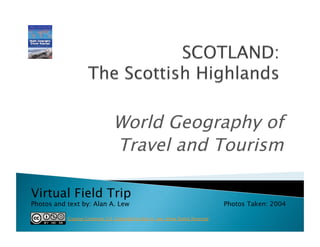
- 1. World Geography of Travel and Tourism Virtual Field Trip Photos and text by: Alan A. Lew Photos Taken: 2004 Creative Commons 3.0 Copyright by Alan A. Lew: Some Rights Reserved
- 3. Includes the rugged and mountainous regions of Scotland north and west of the Highland Boundary Fault. Most of the southern half is part of the Grampian Mountains, with highest mountain in the British Isles, Ben Nevis, in the southwest. Considered one of the the most scenic regions of Europe and heavily visited by tourists in the summer months. One of the most sparsely populated regions of Europe, following large migrations to the Scottish Lowlands in the 19th c., where the industrial revolution cities of Glasgow and Edinburgh are located.
- 4. The mountains, valley and lakes were all shaped by the glaciers that covered almost all of Scotland in the ice ages that ended about 11,000 years ago. Hiking trails, a tourist on a motorcycle, freshly cut lumber, and peat bogs (top left) can be seen in these photos.
- 5. Most of the tourists come to the Scottish Highlands in the summer months by motorcycle, car, tour bus, and caravan/RV.
- 6. Fort William is the largest town in the Highlands (Inverness is larger, but is a city, not a town). It is situated on Loch Linhe, which is an ocean estuary or fjord. Loch Eil, a freshwater lake, lies immediately to the north of the light green marshland that separate it from Loch Linhe.
- 8. The Loch Ness Monster legend makes fresh water lake a favorite tourist destination.
- 9. Loch Ness area attractions include Urquhart Caster (above), camping, and boat trips. The sign at the private campground reminds continental Europeans to keep left on UK roads.
- 11. Loch Lomond National Park is in the Scottish Lowlands. It is a popular camping, hiking and fishing area close to Glasgow.
- 12. A fault line runs from northeast (top-right) to southwest (bottom- left) of this model of Loch Lomond. To the north is the Scottish Highlands, to the south is the Scottish Lowlands.