
Recomendados
Recomendados
Mais conteúdo relacionado
Semelhante a Allinsite warankqa 1 ¨demo¨ (1)
Semelhante a Allinsite warankqa 1 ¨demo¨ (1) (20)
Último
Último (20)
Allinsite warankqa 1 ¨demo¨ (1)
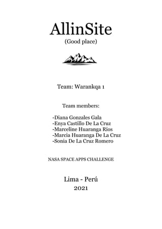
- 1. AllinSite (Good place) Team: Warankqa 1 Team members: -Diana Gonzales Gala -Enya Castillo De La Cruz -Marceline Huaranga Ríos -Marcia Huaranga De La Cruz -Sonia De La Cruz Romero NASA SPACE APPS CHALLENGE Lima - Perú 2021
- 2. INTRODUCTION The purpose of this project is to create an application that helps people to make decisions in choosing a safe place for the construction of their home. This application is oriented to low-income migrant populations who decide to settle in a certain place. This application takes into account the risks of disasters that would be exposed such as floods, landslides, avalanches, river overflows, recurrence of earthquakes, etc. Crossing data on the type of existing soil, accessibility facilities and the presence of existing equipment around that area. It was a personal interest to be able to develop an application that helps in the preventive management of disasters. In this way, we can spread a preventive culture in the population and at the same time work collaboratively with some authorities in obtaining relevant information for an optimal disaster risk management. PROBLEMATIC According to the UN there are 272 million migrants in the world. Peru receives approximately 200,000 foreign migrants per year, and in Lima 2,800,000 people live on the hillsides. In the search for a better quality of life, there is the origin of these migratory phenomena and a large percentage of these people either by necessity and / or ignorance establish their housing in potentially risky places and that in the future disasters could happen with possible material and human losses. In the case of Peru, it is necessary to remain alert to any event, since the geographical area in which it is located is prone to natural phenomena of different types. INFORM (2018) reports that Peru is ranked 68th out of 191 countries according to its vulnerability to risks present in natural disasters most likely to happen, the most worrisome being earthquakes, floods, heavy rains, low temperatures and droughts. In view of these warnings and the unfortunate events that have been occurring in Peru, the authorities are seeking to develop policies, strategies and actions to reduce the impact of natural phenomena. GENERAL OBJECTIVE To design a mobile application that provides easy-to-read information about the risks of natural disasters in a given place and that contributes to people to make better decisions when choosing a place to live.
- 3. TARGET PUBLIC The target public is the low-income immigrant population that has decided to buy a plot of land and build their home in the city to which they have migrated. Governmental entities can use this information for the planning of improvement programs and projects in their territory. THE APP ALLINSITE The app will use a GPS locator and when activated it will simultaneously show in a color bar the percentage of risk presented by the selected location according to the variables mentioned above. The color bar will go from red, which represents the highest percentage of risk, through yellow, to green, which represents the lowest percentage of risk. Variables to be considered in the application: ● Landslides, (caused by rainy seasons, child phenomenon, etc). ● Floods (caused by the proximity to rivers). ● Earthquakes (according to the proximity of the area to the fire belt). ● Soil types (soil types influence the behavior in the event of a catastrophic event such as earthquakes or landslides). ● Accessibility and health facilities (due to the proximity to roads and health facilities). Resources to be used for the app: Data Nasa Landslides (data and historical map of landslides in the world, this is data made by the contributors themselves). https://maps.nccs.nasa.gov/arcgis/apps/webappviewer/index.html?id=824ea5864 ec8423fb985b33ee6bc05b7 The ASTER Global Digital Elevation Model (GDEM) Version 3 (ASTGTM) It provides a global digital elevation model (DEM) of land areas on Earth, which gives us the location of streams and slopes of the world. https://search.earthdata.nasa.gov/search/granules/collection-details?p=C1711961296-LPCL OUD&pg[0][v]=f&pg[0][gsk]=-start_date&g=G1726738155-LPCLOUD&sp[0]=-76.22754%2C- 10.77738&tl=1633306814!3!!&fs10=Terrain%20Elevation&fsm0=Topography&fs20=Topogra phical%20Relief%20Maps&fst0=Land%20Surface&m=-11.379638671875!-77.86669921875! 7!1!0!0%2
- 4. Data Indeci Data Cenepred Data MINAM Ministry of Environment soil maps https://sinia.minam.gob.pe/sites/default/files/archivos/public/docs/2858.jpg Data Google Earth Health facilities and roads. REFERENCES ● A total of 441 highland districts located in 14 regions of the country are at very high and high risk of landslides and/or mudslides, following moderate to heavy rains. (Newspaper Gestión 2020) ● Amazon: Evacuation of families affected by landslides in Santa Maria de Nieva (NEWSLETTER N° 2025 / 22-MARCH-2021). ● bcrp.gob.pe/docs/Publicaciones/Revista-Moneda/moneda-183/moneda-183-09.pdf (return of recent migrants at the time of covid-19) ● Migrations: Over 5 mil foreign nationals were expelled from the country in almost two years of the pandemic (Newspaper El Comercio).
- 5. ANNEXES.